Exposed Lithology Along Polar Fjords
In temperate climates, chemical weathering and thick soils cloak coastal bedrock in green vegetation. Along high-latitude fjords, frost-shattering (gelifraction) and glacial scouring keep cliff faces bare and sharp. The colour of a polar coast is therefore a direct readout of its mineral composition.
In northern Spitsbergen’s Woodfjorden and Wijdefjorden, entire mountain slopes glow deep terracotta and brick red. These are the Devonian "Old Red Sandstones"—river and floodplain sediments deposited roughly 400 million years ago when Svalbard lay near the equator, stained by iron oxide (hematite) coatings around quartz grains. By contrast, along western Greenland’s Disko Bugt and East Greenland’s Blosseville Coast, dark charcoal-brown flood basalts from the opening of the North Atlantic Ocean form towering stepped cliffs (trap topography) above pale metamorphic basement rocks.
| Coastal Region | Dominant Rock / Sediment Type | Characteristic Field Palette |
|---|---|---|
| Woodfjorden, Svalbard | Devonian Old Red Sandstone & siltstone | Terracotta red, dusty rose, and oxidized ochre scree slopes. |
| Kong Oscar Fjord, East Greenland | Neoproterozoic Eleonore Bay Supergroup | Banded mustard yellow, cream dolomite, maroon shale, and dark limestone. |
| Disko Island & Scoresby Sund | Paleogene flood basalts & columnar sills | Deep espresso brown, charcoal black, and olive-weathered palagonite tuff. |
| Herschel Island (Qikiqtaruk), Yukon | Ice-rich glacial till & marine permafrost sediments | Dark umber mud slumps, grey ground-ice lenses, and tan silt plumes. |
Glacial Rock Flour and Fjord Plumes
Where braided meltwater rivers or marine-terminating glaciers enter a fjord, the water rarely looks dark like the open ocean. Instead, sharp colour fronts divide milky jade, olive-grey, and terracotta-tan water masses from dark marine water.
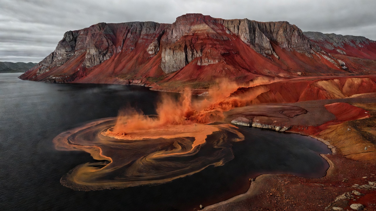
Why Plumes Float on Fjord Water
Even though glacial meltwater carries heavy loads of suspended mineral silt, it is fresh water (zero salinity) and therefore less dense than cold salty ocean water. The sediment-laden plume spreads out as a buoyant surface lens across the fjord, creating razor-sharp colour boundaries visible from cliffs and aircraft.
Illustrative Coastal Swatches
Derived colour swatches are illustrative field references, not scientific measurements.
Raised Beaches and Driftwood Terraces
During the Last Glacial Maximum, ice sheets up to three kilometres thick pressed the Earth's crust down into the underlying mantle. After the ice melted back between 12,000 and 6,000 years ago, the land began rebounding upward—a process called glacio-isostatic adjustment that continues today around Hudson Bay, Bathurst Inlet, and Svalbard.
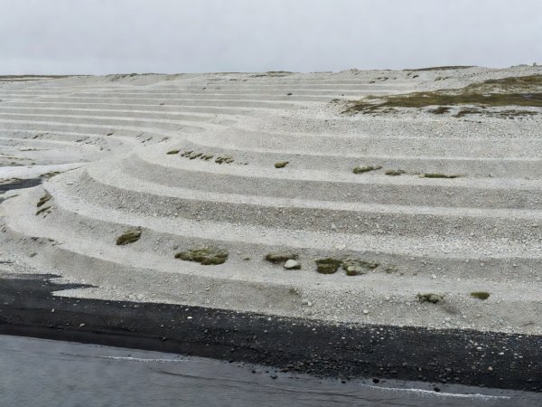
Stepped Gravel Ridges
Each concentric pale gravel ridge stepping up a coastal hillside represents an ancient storm beach lifted out of reach of the waves. On remote islands, bleached silver-grey Siberian larch driftwood and ancient whalebones rest dozens of metres above modern high tide.
Unconsolidated Permafrost Coasts
Not all Arctic coasts are hard rock. Nearly two-thirds of the circum-Arctic coastline—especially along the Laptev, East Siberian, and Beaufort seas—consists of unlithified sand, silt, and peat held together solely by ground ice.
Understanding Thermal Abrasion on Ice-Rich Bluffs
Toppling Tundra Blocks
Along Drew Point in Alaska and Herschel Island in Yukon, dark mud cliffs undercut at their base collapse in large peat-capped blocks into turbid nearshore water during late summer storms.
Thermo-Erosional Niching
When sea ice retreats far offshore in late summer, wind-driven waves have a longer open-water fetch; relatively warm seawater melts a horizontal notch at the base of the frozen bluff until the overhanging tundra collapses.
Arctic Coastal Dynamics Database
Repeat shoreline surveys compiled by the international Arctic Coastal Dynamics (ACD) project document average bluff retreat rates of 1 to 2 metres per year across ice-rich sectors, with localized extremes exceeding 15 metres per year.